In my first of a series of posts about my experiences on Diego Garcia, I’ll write first about the DYNAMO research site, and describe some of what I do for work, which is why I’m here after all.
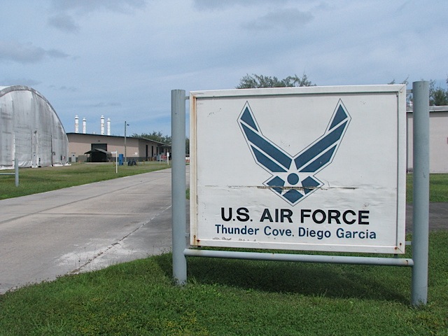
“Downtown” is located at the northwest end of the island, and our research site is about six miles southeast of there. It takes a solid 15 minutes to drive from our hotel to the site because of slow speed limits that are very strictly enforced (speeding tickets are 10 British pounds per mph over the speed limit, and the Brit cops are happy to pull people over going 1 or 2 mph over the limit). The site is located on the U.S. Air Force base, at a place called Tent City (also called Camp Justice). Tent City is a field of cement pads that were poured to accommodate hundreds of troops during wartime operations based from Diego (such as Operation Desert Storm or the beginning of Operation Enduring Freedom).
 |
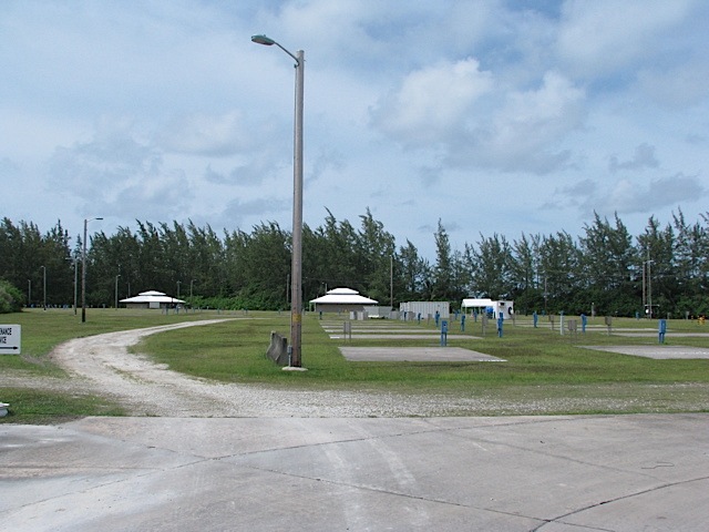 |
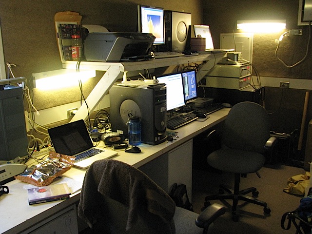
But right now Tent City is virtually empty, and our research trailers (shipping crates, really) are placed on two of the cement pads. One of our crates is full of a bunch of helium canisters, and the other crate is where we spend most of our time. That one has the computers that monitor the various scientific instruments that are on site.
 |
 |
 |
 |
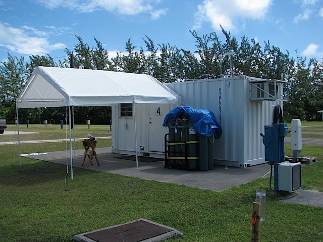
The DYNAMO site is an Integrated Sounding System (ISS) because several sounding technologies are in place here. In the bottom-left photo just above, there are five objects. The middle object is a 915 MHz radar wind profiler. Like the name suggests, it uses radar to measure the wind in a vertical profile and two angled profiles. The radio acoustic sounding system (RASS), which is the four satellite objects around the wind profiler (and integrated with the wind profiler system), measures atmospheric temperature using backscattered radio waves. The RASS turns on for five minutes at the top and bottom of every hour, and makes this lovely sound:
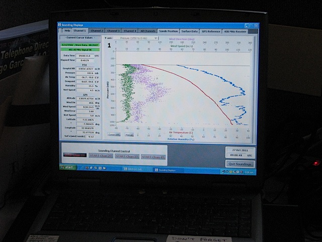
The site also has a ceilometer (pointing vertically) to measure drop size in clouds. That’s also a very handy tool to determine if icing is likely in the clouds above, up to an altitude of about 4 km. If it looks like icing might be a problem, then we need to add extra helium to the balloon to try to give it enough lift to get through the icing region. And we have a webcam to take photos of the sky periodically, but now we’ve been asked to start taking panoramic photographs since the webcam imagery is low-resolution. There also is a rain gauge and a rain collector from which we collect samples for isotope analysis (to try to determine where the rain came from). Here’s the inside of the main trailer with some of the computers displaying the real-time data that’s coming in (the one on the left is data from the weather balloon as it rises).
 |
 |
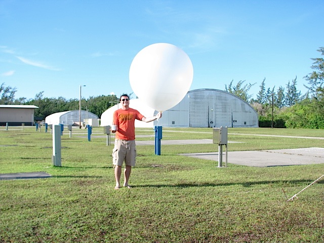
So what’s the process for launching a radiosonde (weather balloon)? Read below to find out.
 |
 |
1. Call USAF Air Traffic Control to get approval for launch. If there are incoming/outgoing flights in the near future, they’ll ask us to wait.
2. Recondition the radiosonde’s humidity sensor for three minutes to burn off any oils or impurities that accumulated during manufacture or transit.
3. Find a GPS radio frequency away from interfering signals, and program it into the sonde and the sounding program on the computer.
4. Hook up the battery pack (six insulated AA batteries) to the sonde, and verify that the sonde’s temperature, humidity, pressure, and GPS sensors are working and within tolerances. The GPS sensor allows measurement of wind direction and wind speed.
5. Aspirate the temperature and humidity sensors of the sonde in environmental (outside) air while shaded, and continue to verify that the sensors are operating within tolerances.
6. Fill up a weather balloon with 30 cubic feet of helium (or 35 cu. ft. if it’s raining, or 40 cu. ft. if we’re worried about icing aloft), and close the bottom of the balloon with a zip tie.
7. Unspool some thread from the spool attached to the sonde, and use another zip tie to attach the spool to the balloon. (As the balloon rises, the rest of the string will unspool and the sonde will dangle about 30 feet below the balloon.) This is usually the most finnicky step.
8. Remove the sonde from the aspirator, hold the sonde upright in an open palm, and release the balloon someplace where it won’t hit any structures or trees (only a worry in windy conditions).
Here’s a video of me doing steps 7 and 8 of a radiosonde launch:
It takes about an hour and a half to two hours for the sonde to rise high enough in the stratosphere for the weather balloon to burst (often as high as 25 hPa, or about 80,000 ft). We have to launch balloons every 3 hours (though right now we’re in a four-day stretch of launches every 6 hours). It only took a couple of launches under someone’s supervision to get comfortable enough with it to do it solo. There are four of us rotating through three shifts (0500-1400, 1400-2300, and 2300-0500 local time), so each time we get done with a shift, we have 24 hours until the start of our next shift. That way none of us gets stuck with any one shift. One neat thing about launching balloons at night (daylight hours are from about 0645-1915 local time) is watching the balloon sail up into the stars!
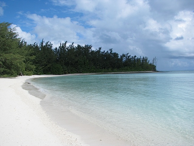
Oh, and when we have a little downtime during the balloon’s ascent or while waiting for the next launch, we can chill out and go for a swim at this lagoon beach about 100-200 yards away from the research site:
 |
 |
All in all, it’s not a bad gig here on Diego Garcia! Stay tuned for more upcoming posts about life on the island.
4 Responses to Diego Garcia: Research Site