In my first of a series of posts about my experiences on Diego Garcia, I’ll write first about the DYNAMO research site, and describe some of what I do for work, which is why I’m here after all.
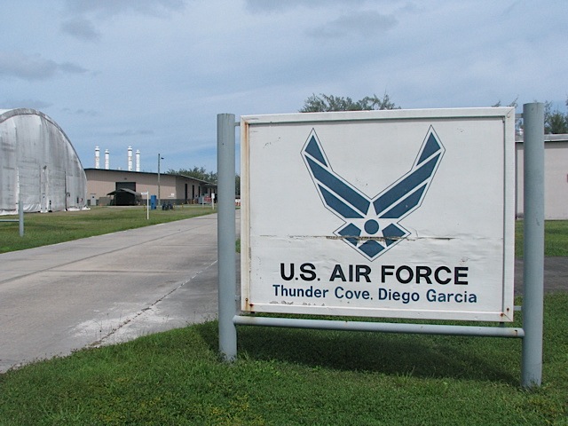
“Downtown” is located at the northwest end of the island, and our research site is about six miles southeast of there. It takes a solid 15 minutes to drive from our hotel to the site because of slow speed limits that are very strictly enforced (speeding tickets are 10 British pounds per mph over the speed limit, and the Brit cops are happy to pull people over going 1 or 2 mph over the limit). The site is located on the U.S. Air Force base, at a place called Tent City (also called Camp Justice). Tent City is a field of cement pads that were poured to accommodate hundreds of troops during wartime operations based from Diego (such as Operation Desert Storm or the beginning of Operation Enduring Freedom).
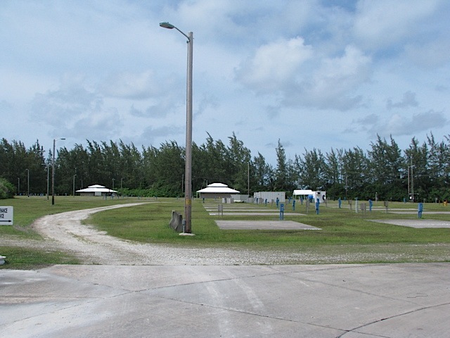
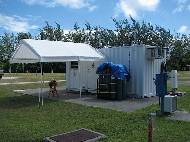
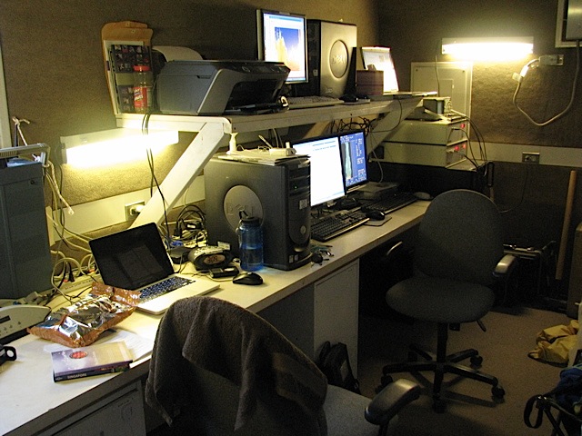
But right now Tent City is virtually empty, and our research trailers (shipping crates, really) are placed on two of the cement pads. One of our crates is full of a bunch of helium canisters, and the other crate is where we spend most of our time. That one has the computers that monitor the various scientific instruments that are on site.
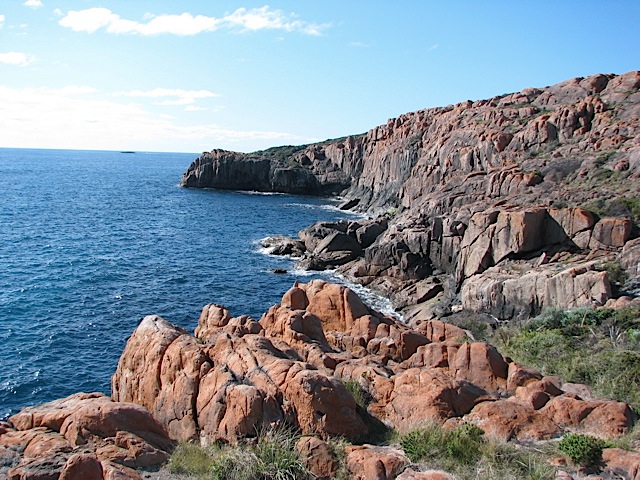
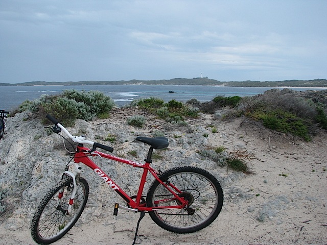
The DYNAMO site is an Integrated Sounding System (ISS) because several sounding technologies are in place here. In the bottom-left photo just above, there are five objects. The middle object is a 915 MHz radar wind profiler. Like the name suggests, it uses radar to measure the wind in a vertical profile and two angled profiles. The radio acoustic sounding system (RASS), which is the four satellite objects around the wind profiler (and integrated with the wind profiler system), measures atmospheric temperature using backscattered radio waves. The RASS turns on for five minutes at the top and bottom of every hour, and makes this lovely sound:
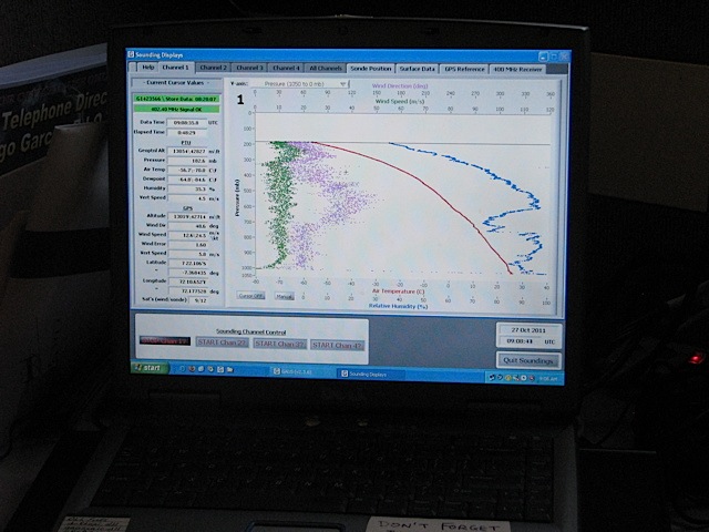
The site also has a ceilometer (pointing vertically) to measure drop size in clouds. That’s also a very handy tool to determine if icing is likely in the clouds above, up to an altitude of about 4 km. If it looks like icing might be a problem, then we need to add extra helium to the balloon to try to give it enough lift to get through the icing region. And we have a webcam to take photos of the sky periodically, but now we’ve been asked to start taking panoramic photographs since the webcam imagery is low-resolution. There also is a rain gauge and a rain collector from which we collect samples for isotope analysis (to try to determine where the rain came from). Here’s the inside of the main trailer with some of the computers displaying the real-time data that’s coming in (the one on the left is data from the weather balloon as it rises).
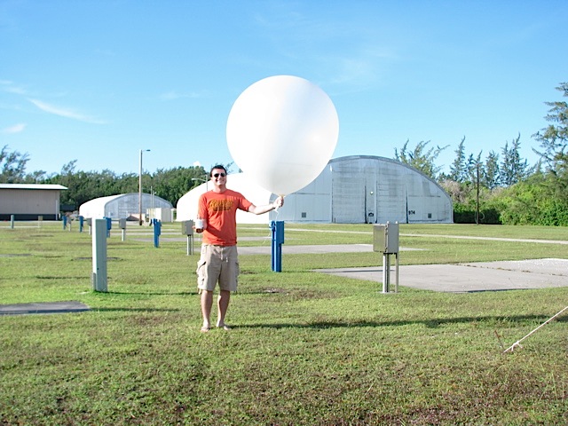
So what’s the process for launching a radiosonde (weather balloon)? Read below to find out.
1. Call USAF Air Traffic Control to get approval for launch. If there are incoming/outgoing flights in the near future, they’ll ask us to wait.
2. Recondition the radiosonde’s humidity sensor for three minutes to burn off any oils or impurities that accumulated during manufacture or transit.
3. Find a GPS radio frequency away from interfering signals, and program it into the sonde and the sounding program on the computer.
4. Hook up the battery pack (six insulated AA batteries) to the sonde, and verify that the sonde’s temperature, humidity, pressure, and GPS sensors are working and within tolerances. The GPS sensor allows measurement of wind direction and wind speed.
5. Aspirate the temperature and humidity sensors of the sonde in environmental (outside) air while shaded, and continue to verify that the sensors are operating within tolerances.
6. Fill up a weather balloon with 30 cubic feet of helium (or 35 cu. ft. if it’s raining, or 40 cu. ft. if we’re worried about icing aloft), and close the bottom of the balloon with a zip tie.
7. Unspool some thread from the spool attached to the sonde, and use another zip tie to attach the spool to the balloon. (As the balloon rises, the rest of the string will unspool and the sonde will dangle about 30 feet below the balloon.) This is usually the most finnicky step.
8. Remove the sonde from the aspirator, hold the sonde upright in an open palm, and release the balloon someplace where it won’t hit any structures or trees (only a worry in windy conditions).
Here’s a video of me doing steps 7 and 8 of a radiosonde launch:
It takes about an hour and a half to two hours for the sonde to rise high enough in the stratosphere for the weather balloon to burst (often as high as 25 hPa, or about 80,000 ft). We have to launch balloons every 3 hours (though right now we’re in a four-day stretch of launches every 6 hours). It only took a couple of launches under someone’s supervision to get comfortable enough with it to do it solo. There are four of us rotating through three shifts (0500-1400, 1400-2300, and 2300-0500 local time), so each time we get done with a shift, we have 24 hours until the start of our next shift. That way none of us gets stuck with any one shift. One neat thing about launching balloons at night (daylight hours are from about 0645-1915 local time) is watching the balloon sail up into the stars!
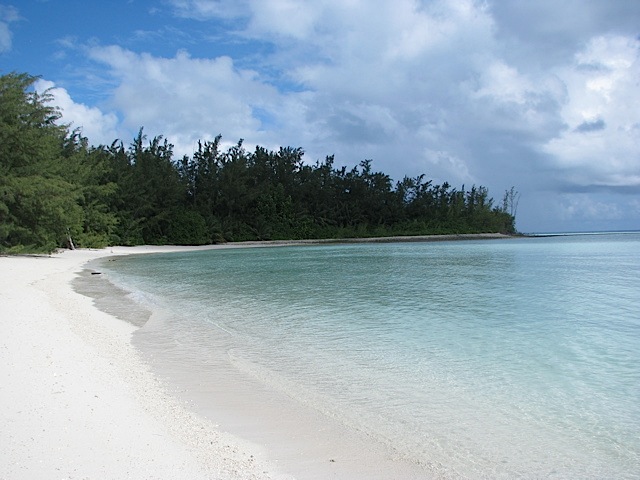
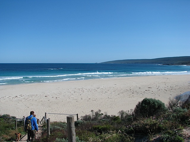
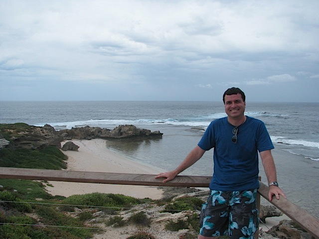
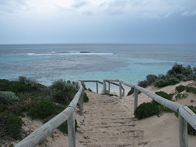
Oh, and when we have a little downtime during the balloon’s ascent or while waiting for the next launch, we can chill out and go for a swim at this lagoon beach about 100-200 yards away from the research site:
All in all, it’s not a bad gig here on Diego Garcia! Stay tuned for more upcoming posts about life on the island.
After having spent a day and a half in Singapore, it was time to fly to Diego Garcia on 25 Oct for the main part of my Indian Ocean adventure! I met up at the hotel in Singapore with Rachel & Adam, the two Colorado State University atmospheric science grad students who are on Diego with me, and we took a taxi to the Singapore military airport at Paya Lebar. The cabbie didn’t know where exactly to drop us off, and neither did we. Rachel & Adam had a hand-drawn map that someone had emailed them, but it apparently didn’t contain enough info for our cab driver (or even a military guy at a bus stop who we asked for help) to understand what it was a map of. Oh well! Eventually we got to the right place. Obviously no pictures were allowed because it was a military airport.
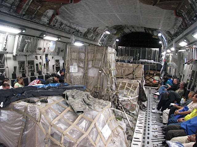
At the terminal we met Heather, the NCAR technician who’s here as our supervisor on the island. She was supposed to fly out the day before, but the DC-8 was on the fritz (she still had to wait for 6 hours at the airport the day before, though), so instead she wound up flying out the same day as us. After about 2-3 hours of waiting in the small terminal we boarded a bus that drove us out on the tarmac to where the C-17 was sitting. The safety briefing about the plane seemed pretty standard, until the guy at the microphone got to the part about lifejackets. Then he paused for a bit, clearly trying to figure out what to say next, and then simply said, “Umm, the lifejackets are pretty self-explanatory, you all know how to put one on.” I thought that was pretty funny, and not “by the book” like you’d expect the military to be.
The flight itself wasn’t as wasn’t freezing cold like we were warned it would be. I had on jeans and a t-shirt, and if anything, I was too warm during the flight because of the heat vent right above my seat. So the long sleeve shirt, hoodie, hat, and gloves that I packed are all useless until I land in Colorado in late November. However, the plane was pretty loud. When I had my earplugs in the flight sounded about as loud as a normal commercial jet, but I could barely hear the person next to me, so they were definitely doing their job. Also, the seats were quite uncomfortable, mainly because of the lifejacket that served as a “lumbar support.” During takeoff and a bout of turbulence mid-flight I was also really wishing there were windows to look out of while we were seated (each side had only two or three small windows in the entire main cabin). Here are some photos from the flight:
In the top right photo, my seat was next to the guy in the foreground at the bottom left corner (I sat to his right), so my view was staring at the boxes in the foreground. Scenic!
Eventually we landed in Diego Garcia at night, and got a cool stamp in our passports for British Indian Ocean Territory. There was even a British diplomat of some sort on the plane, and he was excited to get a BIOT passport stamp. We got a ride to our hotel from one of the students that we were replacing, and then Heather, Rachel and I walked down to the Ship’s Store (the general store) to buy a beer or two to celebrate that we actually landed on this remote tropical island. It was exciting to be here at long last.
Next time: some photos and stories from our first couple days on Diego! I’m going to try to make the posts about the island more bite-sized and frequent, rather than infrequent and novella-sized.
My flight from Perth landed in Singapore back on Sunday evening (23 Oct), but with less than 48 hours in the city before my flight to Diego Garcia, I decided not to waste any time and get started on exploring Singapore! So I checked into my hotel (which is the nicest I’ve ever stayed in, the Crowne Plaza at Changi Airport), dropped off my bags, and hopped on the train into the city center.
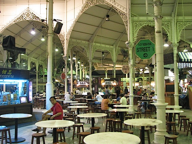
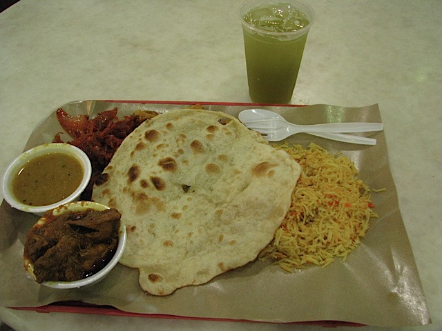
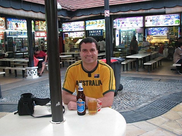
My first mission was to find some dinner, so I went to one of Singapore’s best hawker centres, Lau Pa Sat, near the Raffles Place metro station downtown (it took forever for me to find my way out of the underground mall at that station — Singapore’s quite fond of endless underground malls, it seems). Hawker centres are essentially food courts with hundreds of stalls selling various foods and drinks, and are generally pretty cheap (and cheaper than the actual “food courts” in malls). Apparently you can’t say you’ve been to Singapore without going to at least one hawker centre. After much wandering around, I settled on some Indian food for S$7 and some sugarcane juice for S$2. Sugarcane juice is quite tasty, I might add, even though the “pea soup green” color might not look terribly appetizing. It was also most welcome to have a cheap meal after burning through money like crazy for food in Australia.
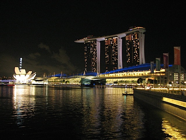
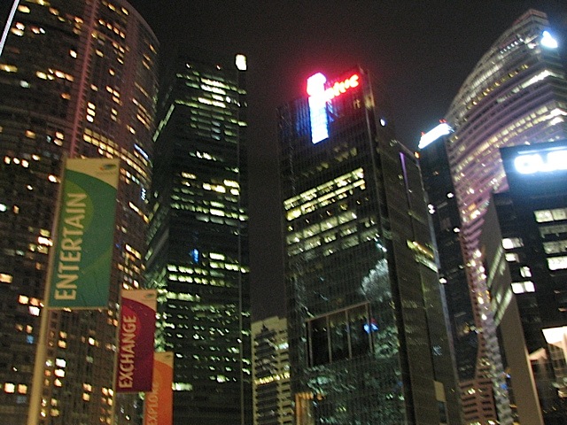
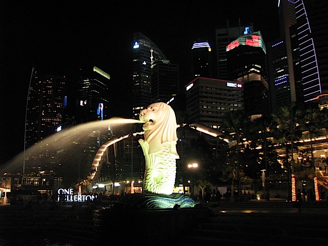
After that I wandered around the CBD and Colonial District areas a bit, making sure to check out Merlion Park. The Merlion, a half-mermaid half-lion fountain, is probably Singapore’s most famous icon. And even though it was nighttime, the humidity in Singapore was oppressive (it’s practically on the equator, after all). Being in Singapore made me absolutely adore air conditioning more than probably any other place I’ve ever been. It was cool to see the CBD and waterfront at night though.
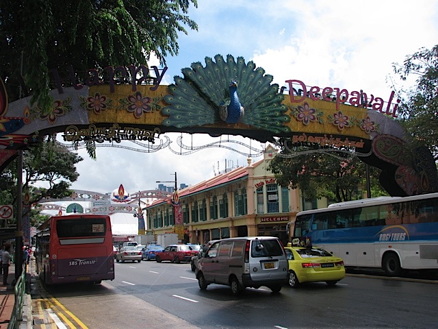
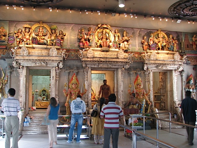
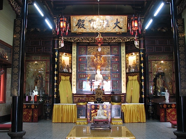
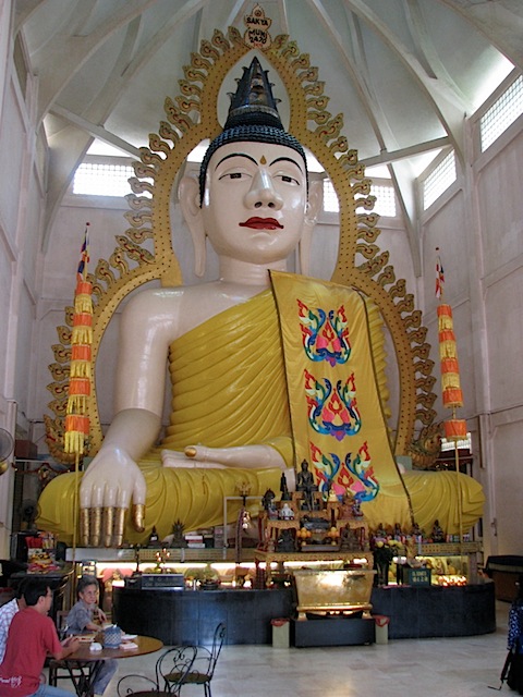
On Monday the 24th I took the train back into the city, first to the Little India neighborhood, roughly following the walking tour that my Lonely Planet guide set out. It’s a neat, colorful, scented place. The district was also even more abuzz and decorated than usual because Deepavali, a Hindu celebration, was going on. While walking around Little India I also went into a couple of Hindu and Buddhist temples. The Hindu temples in particular had many visitors because of Deepavali. Many candles and food sacrifices were being offered to the idols.
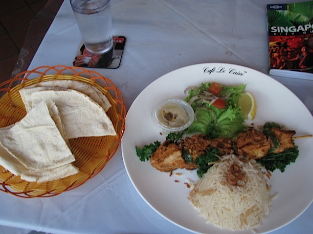
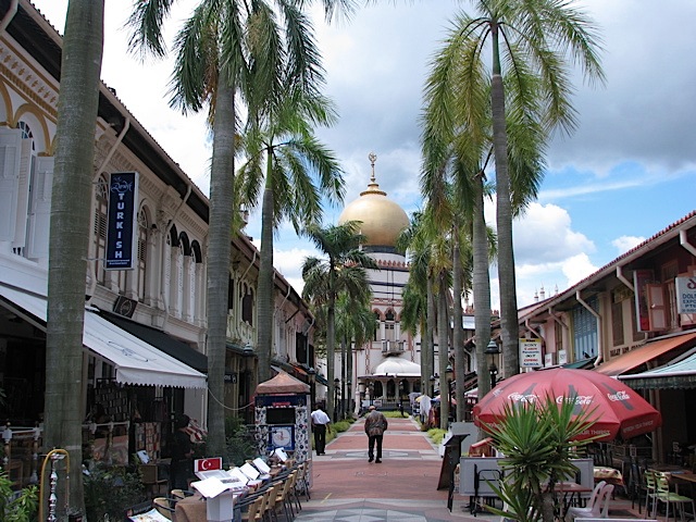
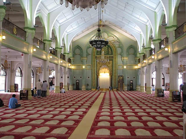
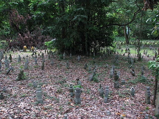
From Little India I walked over to the neighboring Kampong Glam district (referred to by tourists as the Arab district). After getting a good lunch at Cafe Le Caire (rated by Lonely Planet as the best Middle Eastern restaurant in Kampong Glam), I then checked out the beautiful Sultan Mosque. To go inside I had to put on a blue robe-like garment since I was wearing shorts. It was interesting to read the info boards promoting Islam. Some of that info sure didn’t seem to jibe with what’s going on in the world in Muslim countries today (especially about attitudes toward other religions or status/treatment of women)… In theory I wasn’t allowed in the main prayer hall since I am not Muslim, but one of the tour guides said I could go inside and pray to “see what it’s like.” I said that I was a Christian and respectfully declined the opportunity. The young man gently persisted, saying that Islam and Christianity were “pretty much the same.” I basically told him that I didn’t agree, but politely got out of that conversation. I just didn’t feel like that was the time or place to start a theological discussion, especially with a person who I didn’t know. After leaving the mosque I walked up past the Kampong Glam cemetery (and another mosque) on my way to a metro station.
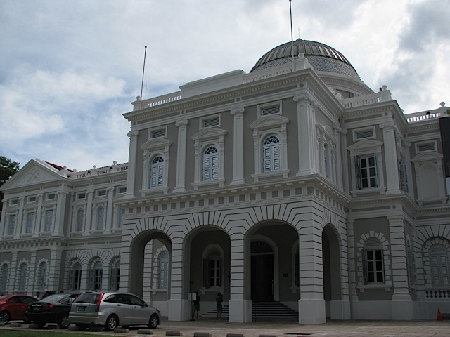
I took the metro over to Dhoby Ghaut to check out the National Museum of Singapore, as much for the history lesson as for the afternoon respite in air conditioning. I only checked out the Singapore national history gallery, which was pretty neat. They handed out headphones and a media player to guide you through the exhibits. There really weren’t descriptions of the artifacts on the walls, only numbers to punch in to the media player to read or listen to a description. It was cool to see the history of Singapore from around 1000 A.D. to English colonization to Japanese invasion to Singaporean independence.
After an hour and a half in the museum I took the metro up to Newton to have dinner at the Newton Circus Hawker Centre. The touts for the various stalls were quite aggressive there, and the food was a lot more expensive than at Lau Pa Sat the night before. One tout said he had cold Tiger Beer (the ubiquitous Singaporean lager, which is actually pretty decent), and when he could see that I was at least interested, before I knew what happened he’d opened the beer for me and set it down on the table and put a menu in my hands. At that point I figured I should just sit down and find something to order. The Tiger Beer was well deserved anyway at the end of such a long, hot day. And you have to sample the local beer when traveling, right?
I made it back to the hotel in time to go for a quick swim in the pool, which, disappointingly, was no deeper than 4 feet. And as hard as they tried to create a tropical getaway atmosphere at the outdoor pool, the hotel and pool is still situated between the air traffic control tower and a runway. But oh boy did that pool feel good after walking around all day in the tropical heat and humidity!
There’s still more of Singapore that I’d like to see, especially Sentosa Island, but that will have to wait until after I get back from Diego. There wasn’t time to go see any more of Singapore the next day because of our flight. More on that — and Diego Garcia — coming up next time!
What a week! My third visit to Australia is over and done with. This one went by really quickly, just six days. This was by far my shortest visit yet to Australia. While a six-day visit from Colorado wouldn’t be worth it because of how expensive it is to get there and how long it takes to get there, a six-day visit from Singapore is worth it. Here’s a rundown of some of what I did and saw in W.A. (Sometime after I leave Diego Garcia I’ll post full photo albums on Facebook.)
Mon 17 Oct: South Perth
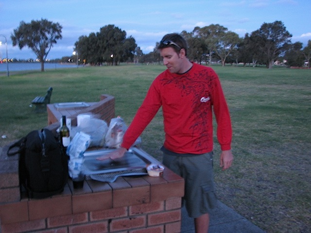
After my arrival in Perth and getting a chance to wash up and whatnot, Bob & I grilled some steaks at a park along the Swan River in South Perth. The river nicely reflected the city lights of the Perth CBD. I also made the discovery that jet lag + very little sleep in the previous 72 hours + about half a bottle of wine = EARLY bedtime. It felt so good to sleep though!
I’d also just like to say how much I prefer Qantas to United or almost any American-based airline, especially for longer flights. On my flights between Singapore & Perth, every seat had its own monitor and media controller, so I watched two movies instead of sleeping. The food is also actually decent on Qantas. As an added bonus, Qantas serves ice cream after dinner, too! So there are more reasons why Qantas is my favorite airline, beyond the fact that it usually means I’m flying to/from/within Australia. 🙂
Tue 18 Oct: Fremantle
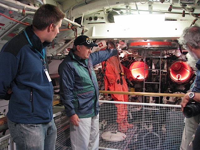
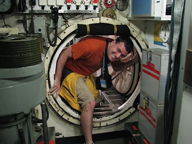
On the 18th Bob & I drove down to Fremantle, a vital port city at the mouth of the Swan River (Perth is 20 km upriver). We went to the Western Australia Maritime Museum. The Maritime Museum has a 1960s-era submarine on display, the HMAS Ovens, and we got a tour through it from a former submarine sailor with the Royal Australian Navy. That was pretty neat, and my first time ever in a submarine. The Maritime Museum also had a host of other ships on display too, including the Australia II which won the America’s Cup in 1983, and a boat on which some guy made three consecutive world circumnavigations (one westward, two eastward).
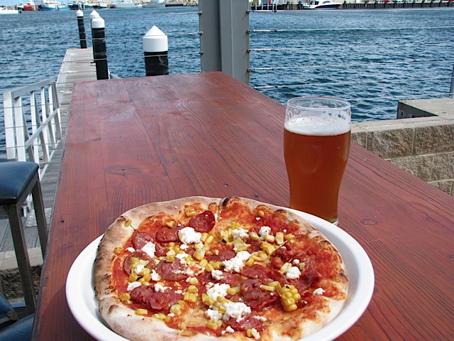
Bob went back to Perth to go to work, but I stuck around in Fremantle for lunch at a brewery called Little Creatures (selling shirts that said “Drink a Little,” haha). This is where I was once again reminded just how expensive eating out is in Australia. My pint cost A$10, and my pizza (intended for one person) was A$21 (A$ and US$ are roughly equivalent at the moment).
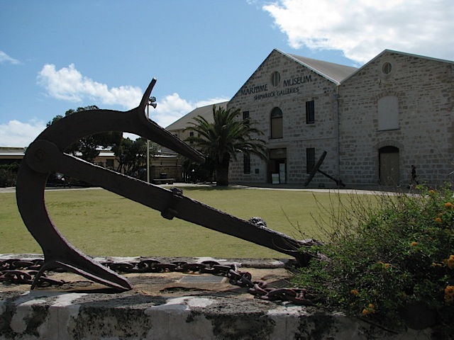
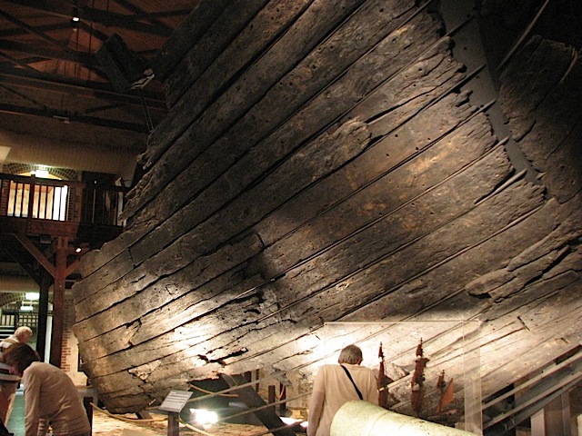
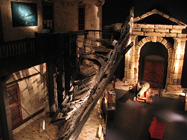
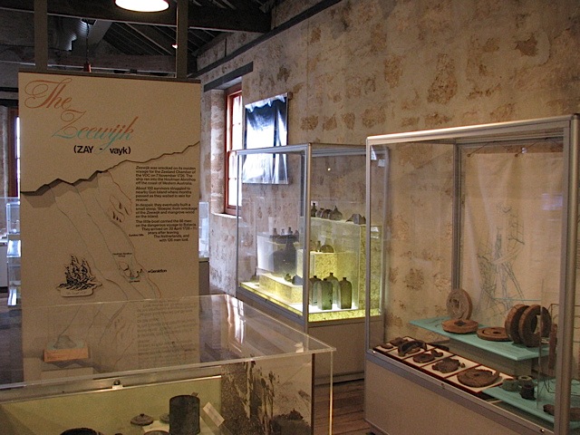
Then I also visited the Maritime Museum Shipwreck Gallery. The museum was all about shipwrecks off the WA coast, focusing on four Dutch East India Company (VOC) shipwrecks, the Batavia (1629), the Vergulde Draak (1656), the Zuytdorp (1712), and the Zeewijk (1747). Many artifacts from all four ships have been recovered, and a part of the wooden hull of the Batavia has been recovered and reconstructed as well. The story of the Batavia wreck and mutiny is really a fascinating one.
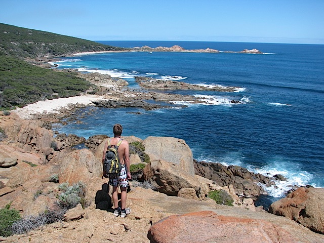
Wed 19 Oct: Cape Leeuwin & Cosy Corner
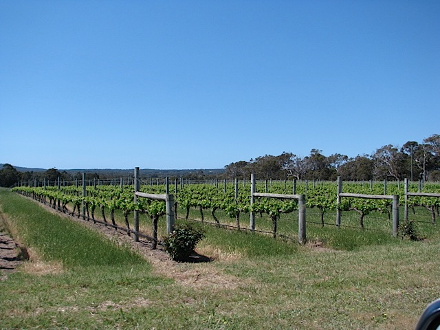
On the 19th Bob & I drove 3 hrs down to the South West, a top vacation spot for Perth residents. It’s an area filled with spectacular beaches, more than a hundred wineries, and more than 300 caves.
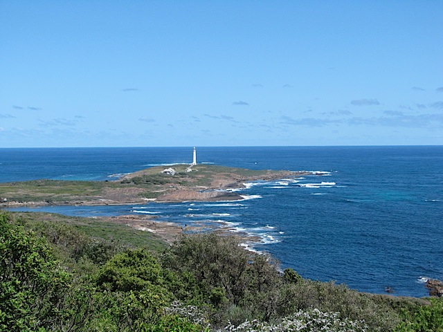
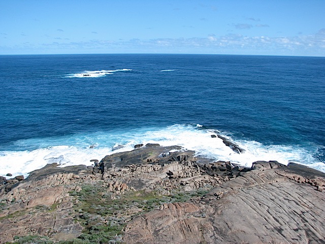
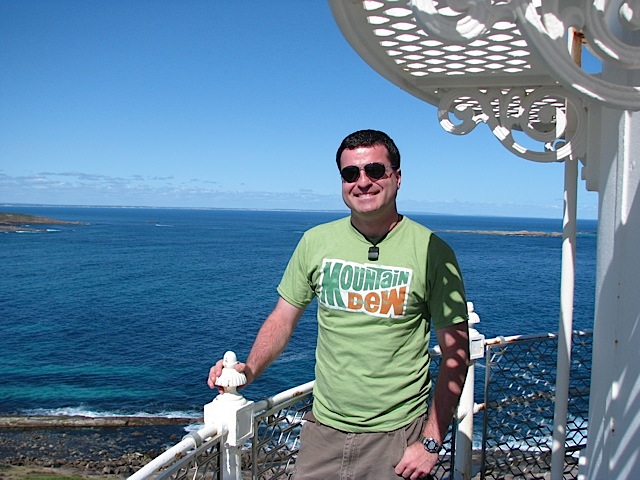
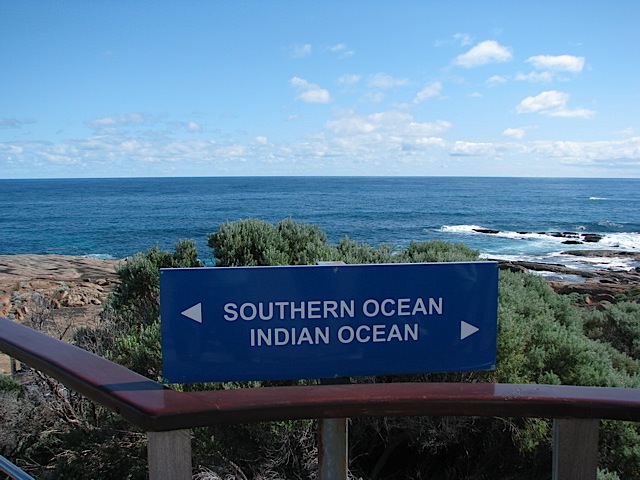
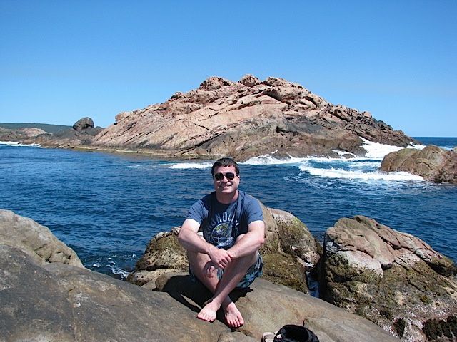
Our first stop was all the way down at Cape Leeuwin, the southwesternmost point in Australia, where the Southern Ocean meets the Indian Ocean. The odd currents that this creates, combined with numerous rocks and islands off shore makes Cape Leeuwin one of the most dangerous capes in the world; almost two dozen known shipwrecks have occurred offshore there. Cape Leeuwin’s picturesque lighthouse is the tallest in Australia, and is still in use. I took a tour up to the top, which provided some spectacular views.
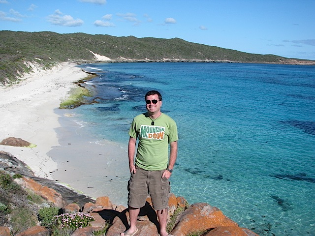
After Cape Leeuwin, we made our way back up the Indian Ocean coastline on Caves Road to Cosy Corner Beach, Redgate Beach, and Ellenstown Beach, before spending the night at a hostel in Margaret River, the main town in the region.
Thu 20 Oct: Yallingup & Cape Naturaliste
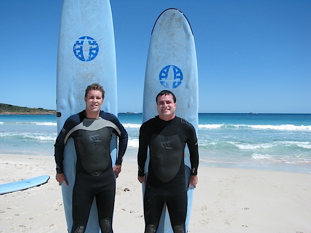
On the morning of the 20th Bob & I took a private surfing lesson at Smiths Beach near Yallingup. It was Bob’s first ever lesson, and my second. In my first lesson, which was almost exactly 7 years ago at Lorne, VIC, along the Great Ocean Road, I never managed to stand up on my board, and only successfully rode into shore on my knees once. This time I was determined to do better, and I did! It took me a few tries, but I managed to stand up a few times on my board! I still couldn’t get up to my feet every time, but I know I made big progress. And with only two of us in the lesson, our instructor gave both of us quite a bit of very helpful attention and suggestions. The weather was also fantastic for the surf lesson.
Following the surf lesson we popped down the beach a couple kilometers to a place called Canal Rocks. These are metamorphic rock outcrops through which the pounding surf has carved several canals, making several islands. This was one of those special places where I could’ve spent all day watching and listening to the roaring waves.
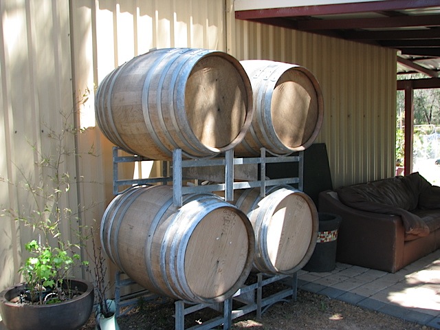
After Canal Rocks we swung by a winery called Windgate. In the Margaret River region you can hardly throw a stone without hitting a winery, there are so many. Apparently I was uncouth with the order in which I tasted the various wines, but oh well. I didn’t buy a bottle (since I only had a couple days left in Aus), but Bob did. Believe it or not this was the first winery I’d ever visited and done a tasting at (my parents and I drove into a winery in New Zealand in 2004 but didn’t pop in for a tasting). Wisconsin, Pennsylvania, and Colorado are not exactly prime wine regions, to say the least.
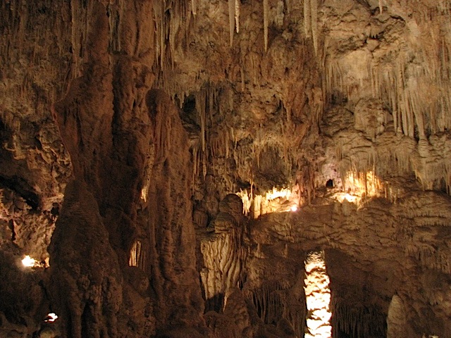
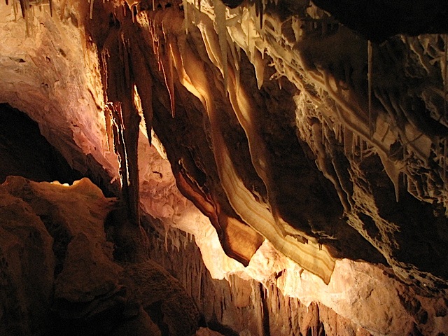
Then it was off to Ngilgi Cave (pronounced NIL-gee). The tour of Ngilgi Cave was semi self-guided, and was quite interesting. Ngilgi is especially known for its numerous shawl formations, which are stalactites that resemble sheets or curtains; Bob & I thought they looked like strips of bacon. Mmmm, bacon… I think that Ngilgi was the first cave I’d been in since Mammoth Cave in Kentucky with my parents back in 1994.
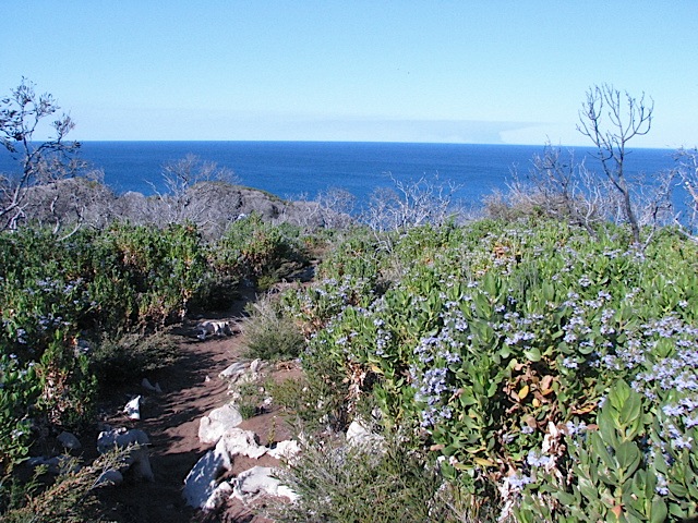
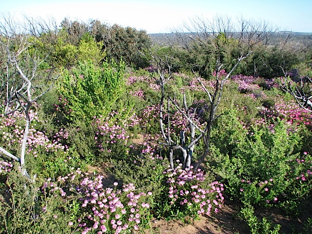
After being underground for an hour, we popped up to Cape Naturaliste for a bushwalk. I didn’t feel the need to get a tour of the Cape Naturaliste lighthouse since it’s short and well inland. On that walk the wildflowers were quite spectacular, and we spotted a few whales in Geographe Bay as well.
Then it was back to Margaret River for the night again. Here’s a funny story. While Bob was off swimming laps in the local pool, I was sorting through some photos on my laptop in a common area of the hostel. At one point this eccentric-looking girl walked up and asked if she could sit on the couch too. Before I could even move all my stuff off that side of the couch, she plopped down. She had long blonde hair, a hat, a backpack, a CD walkman, a long white flower, an Australian hymn book, and a big bottle (white wine?) that she kept drinking from. She really gave off the crazy vibe (or the hippy vibe, I wasn’t quite sure at first). She had headphones on listening loudly to music, and I noticed she was very frustrated that her computer wasn’t working. Eventually, out of the blue, she blurted that she worked for the CIA. That caught my attention. I decided to play along and asked several questions. I’ll sum up her rambling, incoherent story. She said she was 34 years old (she looked about 23), that she was from Margaret River, and that the CIA recruited her when she was 16 to be a typist. She also said that the hostel was on UN property, and that that meant that WA cops couldn’t come on the property. She said her house had also been broken into three times, all three times with only her U.S. passport (despite being an Aussie) being stolen and nothing else. She then started quoting her passport numbers to me, and started them all off with an ‘H’ (which they don’t). Then she said she had a New Zealand police badge, because her mother was once a secretary for two years for NZ PM Muldoon during his tenure. It was bewildering trying to keep up with everything, haha. Eventually she got up and walked off for a moment, and the hostel clerk asked me if I knew her. I said no, and that she was “bat-shit crazy.” He said he’d heard reports from other hostel employees and guests of a woman fitting her description that was becoming a problem. A minute later I saw the hostel clerk trying to escort her off the property. I heard him ask, “You have to leave, can I get you a taxi?” To which she replied, “I don’t do taxis.” That was the last I heard or saw of her, but I definitely got my fill of crazy for the night!
Fri 21 Oct: Penguin Island & Perth
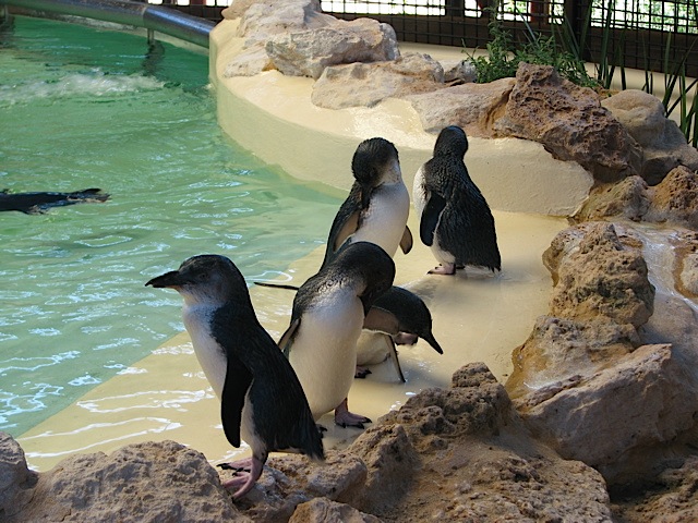
Bob had to work on the afternoon of the 21st, so we hit the road back to Perth in the morning. Along the way we stopped in Rockingham, a southern suburb, to take a ferry over to Penguin Island. Penguin Island is quite small (only about 45-60 minutes to walk around), but is a sanctuary for many types of birds, including seagulls, pelicans, terns, and fairy penguins. There’s also a penguin centre on the island that is home to several rescued penguins. We checked out a feeding there before heading “back to Australia,” as the ferry operator termed it. (I’m pretty sure we didn’t need our passports for the 5-minute ferry ride to the island though, haha!).
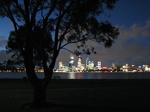
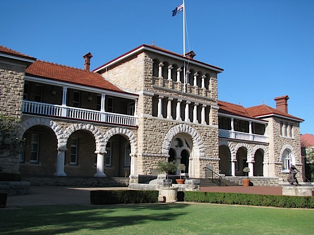
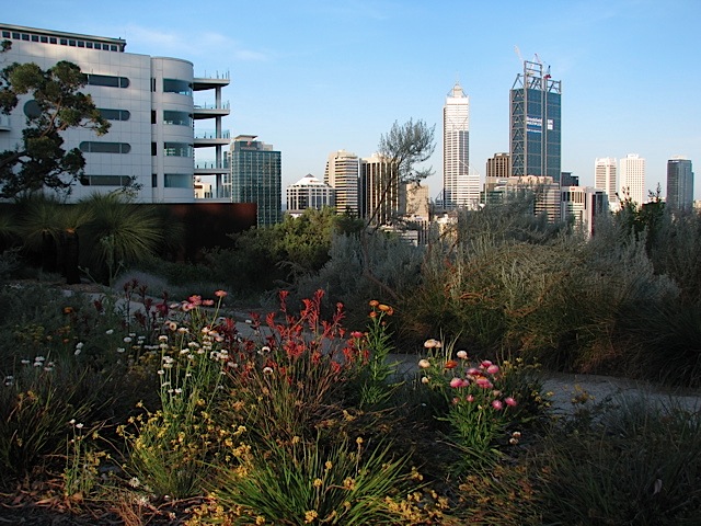
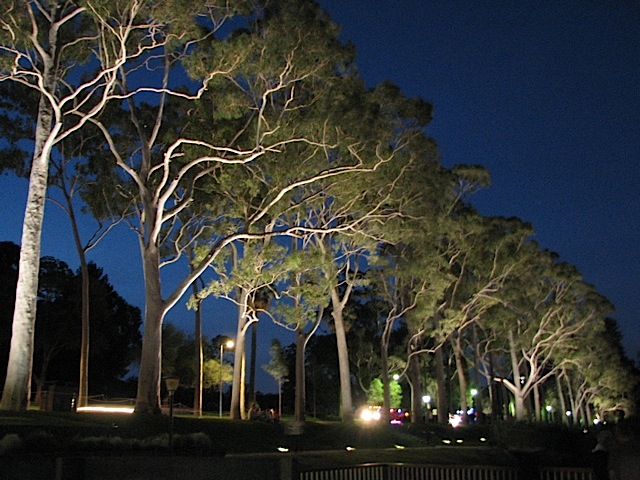
After Bob went to work, I made my way down to the Perth Mint. Unfortunately I was 20 minutes late for the last tour of the day, bummer. I’d hoped to watch gold being poured into bars, and to touch a huge gold nugget. I wandered back through downtown Perth, and made my way to Kings Park, a huge 9 sq. km park just outside of and overlooking the city centre. It was already early evening, so I didn’t go too deep into the park, most of which is unlit. I did stick around for some nice nighttime views of the city, though.
Sat 22 Oct: Rottnest Island
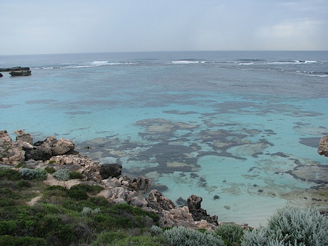
I got up in the morning and took the train down to Fremantle, where I caught a ferry out to Rottnest Island, about 20 km off the coast. There I rented a bicycle, as that’s the best way to get around the island (only a few support vehicles and small tour buses are allowed on the island; no personal or rental cars). The weather wasn’t great that day, about 70 degrees with occasional sprinkles or light rain (and steady rain for the last 30-45 minutes I was on Rotto), so instead of lounging around on one of the many fantastic beaches, I decided to ride my bike around to see as much of the island as I could. I did a complete circuit of the island, including all the way out to the western end, Cape Vlamingh, where I sat and watched three pods of whales offshore for several minutes. All told I biked somewhere around 30 km, which made me quite sore since I hadn’t ridden a bike in about three years! My favorite beach of the day was Ricey Beach. There was absolutely nobody there, and I wanted to linger more than the 20 minutes that I did, but I was still several kilometers away from Thomson Bay with less than an hour until my ferry left. I did just barely catch the ferry on time.
I had a hankering for fish and chips, so when I got back to Fremantle I went to Cicerello’s, one of the most famous seafood places in W.A. Considering everything was fairly expensive, I decided to splurge a few extra bucks for the “Cicerello’s Delight,” a A$32 seafood sampler plate, plus salad and chips. I was in shock when I went to pick up my order from the counter because it was so enormous. It caught the attention of some other diners too, who asked what it was. There was a bowl of clams, about a dozen kalamari curls, a couple prawns, and a couple fish filets (not sure which fish though). It was a lot of food! I managed to finish about 80-90% of it though (all except for a few kalamari twirls and a few chips), which prompted the manager to say to me, unprompted, “That’s a good effort! Many people can’t even finish half of that!”
A little damper was put on the day when I found out that an American diver was killed by a shark off Rottnest Island that afternoon, probably about the time I went for a dip at Ricey Beach, and only a couple beaches over from there. Kinda freaky. It’s the third fatal shark attack in the last two months in Western Australia: one was in Bunker Bay two months ago, not too far from where Bob & I had our surfing lesson; one was a couple weeks ago at Cottesloe, a Perth suburb with a very popular beach that Bob frequents (and which I visited last year); and now the Rottnest one. All the cases happened with cloudy skies, because sharks have a harder time identifying distinct shapes when it’s overcast. Still, it’s not worth living in fear of a shark attack, because it’s more likely that you’ll be struck by lightning or killed in a car accident.
Final Thoughts
I flew back to Singapore on Sunday the 23rd. My six days in Aus went by so quickly. I always wish I could have more time in Australia, but I guess that just means I’ll have to come back for a fourth visit someday! I just wish it weren’t so far away. I still have several other places on my Aussie bucket list to visit, including Uluru, Kakadu, Ningaloo, and Tasmania. Oh darn, a few more trips worth of sightseeing!
So now i’ve been in Singapore for a couple days (blog entry coming eventually), and my flight to Diego Garcia is scheduled to leave this afternoon. There’s a decent chance the flight will be delayed, but whenever I get there I’ll be with only 128k internet for four weeks. I’ll update my blog here occasionally, but there likely won’t be too many photos accompanying them. Let the main act of my Indian Ocean adventure begin!
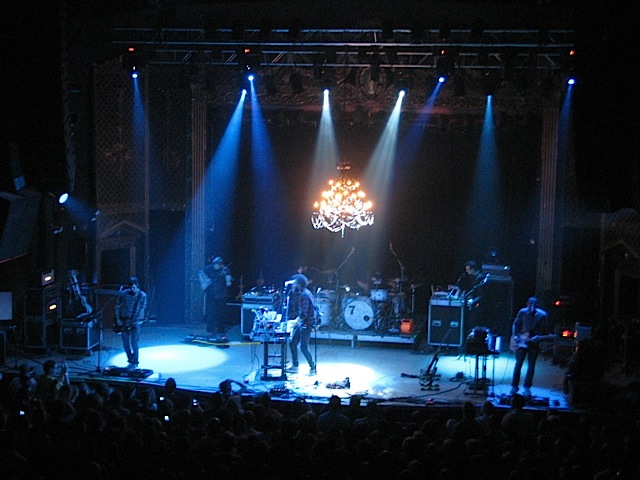
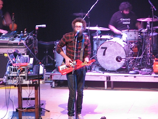
For my final night in Colorado a week and a half ago I went with some friends from Calvary to the David Crowder Band concert, which was sold out at the Ogden Theatre down in Denver. I hadn’t been to the Ogden before this show; it’s a nice little theatre with balconies in back and on the sides. Especially since this is the David Crowder Band’s final tour together, I was kind of surprised they chose a smaller venue like the Ogden, but I think it worked because the show had a more intimate feeling than if it were at a larger venue like the Wells Fargo Theatre (which seats 5,000+ compared to maybe 1000-1500 in the Ogden).
[I would’ve posted this earlier, but it took awhile to get someplace with good internet long enough to upload videos. A couple of the videos are still “processing” on YouTube.]
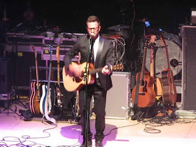
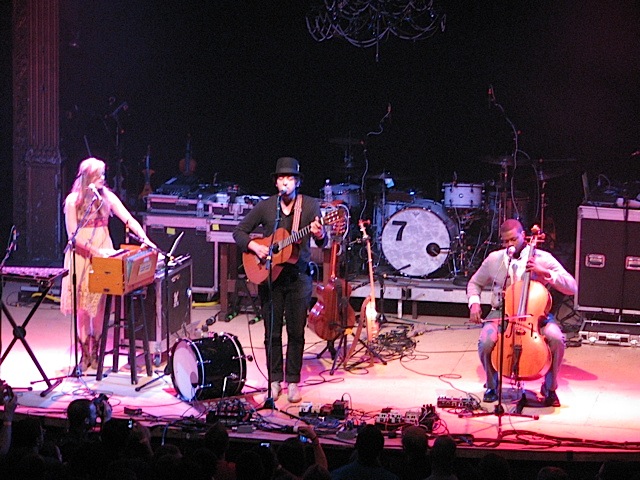
The opening acts were fellow Christian bands/artists John Mark McWilliams, Chris August, and Gungor. I was particularly impressed by Gungor. They didn’t have their whole band, but only three people for an acoustic set. I really, really loved what they did! Here’s a sample:
“When Death Dies”
“You Have Me”
“Beautiful Things”
Seriously, I would’ve paid the price of admission to hear Gungor alone. They were so good that when I got home I bought two of their albums (Ancient Skies and Beautiful Things) so that I could listen to them on my iPod on my trip. They’ll be the headliner at a concert in Colorado coming up sometime in the spring, and I’ll be going to that for sure!
As for this concert’s headliner, the David Crowder Band, they were awesome as expected. They’ve been making great music for 11 years now, with their 7th and final album being released later this year, and it’ll be sad not to have them on the Christian music scene anymore. Their variety of styles, everything from prog rock to bluegrass, is part of what draws me to them. Here’s a sample:
“The Veil”
“A Beautiful Collision”
“Go Tell It On the Mountain”
“I Saw the Light” / “I’ll Fly Away”
One of their encore songs was the Trans-Siberian Orchestra version of “Christmas Eve/Sarajevo 12-24,” which brought the house down. It was just like the TSO version, minus the ubiquitous fireballs and extra spectacle of a TSO concert. But with it being their farewell concert tour, I’m really glad they did some of my favorites from his albums, including “O Praise Him,” “Beautiful Collision,” and “I Saw the Light.”
I’m glad i was able to see The David Crowder Band in concert at least once before they’re done! And a night of worship was a great way to spend my last night in the U.S. before six weeks abroad!